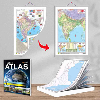
SMALL - 100 India RIVER OUTLINE MAP FOR SCHOOL, 2 IN 1 India POLITICAL AND PHYSICAL MAP IN ENGLISH and SCHOOL ATLAS (ENGLISH) - MAPLITHO | 1 map pad + 2-in-1 map chart + 1 school atlas book |India River Outline Map for school students. Paper Print(30 inch X 20 inch)
Quick Overview
Product Price Comparison
"Introducing Gowoo's combo of SMALL - 100 India RIVER OUTLINE MAP FOR SCHOOL, 2 IN 1 India POLITICAL AND PHYSICAL MAP IN ENGLISH and SCHOOL ATLAS (ENGLISH) - MAPLITHO. The Small - 100 India River Outline Map is a unique map designed for school students to learn about the rivers in India. It shows the basic shape and outline of the rivers across the country. This map is made simple and easy to understand, so you can quickly identify the major rivers of India. It has few labels or extra details, which makes it less confusing and more student-friendly. The measuring small 100 India river outlines map size is 7*8 inch on the map pad. The school atlas maplitho paper size is 8.5*11 inch, and the 2in1 political and physical map size is 20*30 inch. This chart and map are perfect for student use. This map gives you a clear picture of how the rivers flow through different parts of India and their general direction. It's a great tool to help you study and remember the essential rivers of our country.The 2-in-1 India Political and Physical Map combines two crucial aspects of India's political and physical features. The political part of the map shows the states and union territories. This helps you understand the administrative divisions and essential places in the country. The physical part of the map focuses on geographical features like mountains, rivers, and plains. Looking at this map, you can easily see India's different landforms and natural elements. This map is in English, so it's easier to read and understand. It's a great resource to study and explore India's political and physical aspects in one place.The School Atlas (English) - Maplitho is a fantastic book created for school students like you. It is an atlas containing maps to help you learn and understand different places worldwide. This atlas is in English, making it easier to read and follow. Various maps cover political boundaries, physical features, and climate zones. Each map is accompanied by simple and clear explanations, making learning about different regions, countries, and the world easy. This atlas is a fantastic resource to enhance geographical knowledge and develop map-reading skills. It will help you explore and discover new places, understand different cultures, and expand your horizons.The Small - 100 India River Outline Map, 2-in-1 India Political and Physical Map, and School Atlas (English) - Maplitho are all specially designed resources to make learning about rivers, India's political and physical features, and exploring the world more accessible and more enjoyable for school students."

